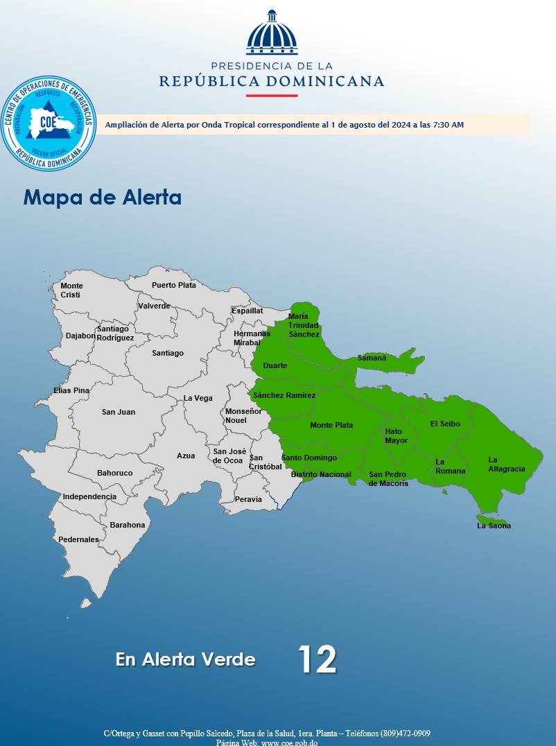
Twelve provinces, including Santo Domingo and the National District, were placed in green alert before the strong showers which are expected for this Thursday due to the passage of a active tropical wave and one trough.
In green alert There are also: Maria Trinidad Sanchez, San Pedro de Macoris, El Seibo, Hato Mayor, La Altagracia, La Romana, Duarte, Sanchez Ramirez, Samana and Monte Plata.
By issuing alerts, the Emergency Operations Center (COE) recommended to people refrain to cross rivers, streams and ravines that have high volumes of water.

Powerful showers
The active tropical wave and the trough will continue to generate showers moderate to strong with electric storms and gusts of wind during the course of this Thursday in several provinces of the country.
Some were recorded early in the morning rains in it Greater Santo Domingobut are expected to occur showers moderate to strong at times
“Since early Thursday morning, they have been observing through the satellite images and the weather doppler radarsignificant increases in cloudiness over different regions of the national territory. Both meteorological systems will continue to cause showers moderate to strong over much of the country, being more frequent and intense in different municipalities of: Greater Santo Domingoextending to other localities during the course of the day and night.
Friday follow rains
This Friday, despite the fact that the axis of the active tropical wave will be over the eastern part of Cuba, there will be enough humidity for cloudy conditions to return from early morning accompanied by showers being moderate to strong, depending on the Indomet.
Tropical wave, and zone of showers
He Indomet monitors a large, disorganized area of showers and electric storms associated with the active tropical wavewhich presents for the next 48 hours, a probability of cyclone formation 10% and in the next 7 days, 60%.

“Regardless of its development, we expect it to generate accumulated rains significant in different provinces of the national territory,” he said.
Possible tropical depression when system passes the Antilles
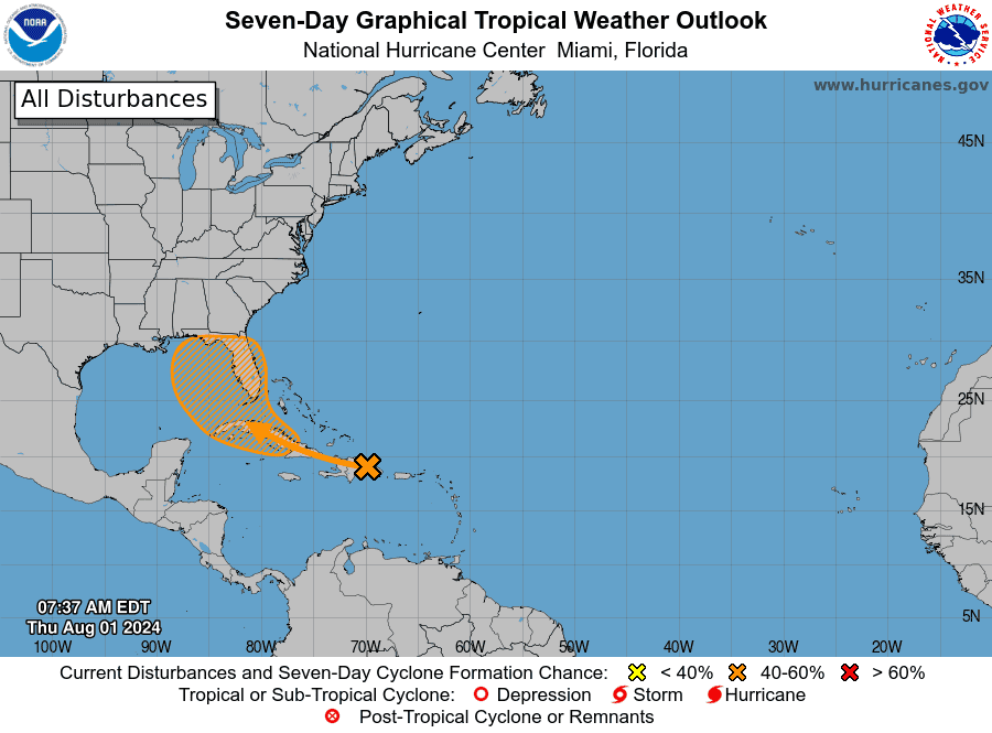
He too National Hurricane Center The United States Department of Health (CNH) indicated that the tropical wave well defined is producing a large area of showers and electric storms disorganized over the Dominican Republic, Puerto Rico, the Virgin Islands, and adjacent waters of the southwest Atlantic and northeast Caribbean Sea.
“Development of this system should be slow during the next two days as it moves west-northwestward over portions of the Lesser Antilles. Environmental conditions are forecast to become more conducive for development after it passes over the Greater Antilles, and a tropical depression could form this weekend or early next week over the Gulf of Mexico or near the Florida Peninsula,” the CNH said.


