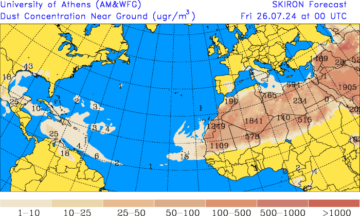
From this Friday and during this weekend in the Dominican territory a mostly cloudy environment will dominate sunny with temperatures very hotdue to a system anticyclonic and to dust of the Saharawhich will continue to have an impact until next Tuesday.
Heriberto Fabián, forecaster at the Dominican Institute of Meteorology (Indomet), informed Diario Libre that this Friday, Saturday, Sunday, Monday and Tuesday there will be particles of dust of the Saharabut on Wednesday there will be a pause and a new one will approach the country tropical wave. It would be passing between Wednesday and Thursday with rain.
Temperatures very hot
High temperatures are expected this weekend temperatures which in the case of Greater Santo Domingo can reach up to 35 °C and a thermal sensation greater than that amount.

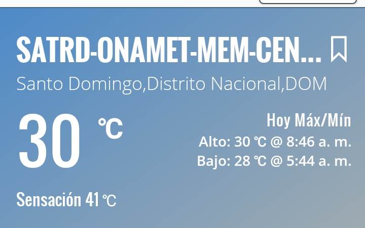
An example of the temperatures The forecast is that at 8:40 a.m. on Friday, despite being early, the National District was already recording a maximum temperature of 30 °C and a thermal sensation of 41 °C. It is recalled that the thermal sensation is the combination of human temperature, ambient temperature and humidity.
The temperature further minimum The temperature recorded today was 28 °C at 5:44 in the morning. This data is provided by the meteorological station of the Indomet in the National District.
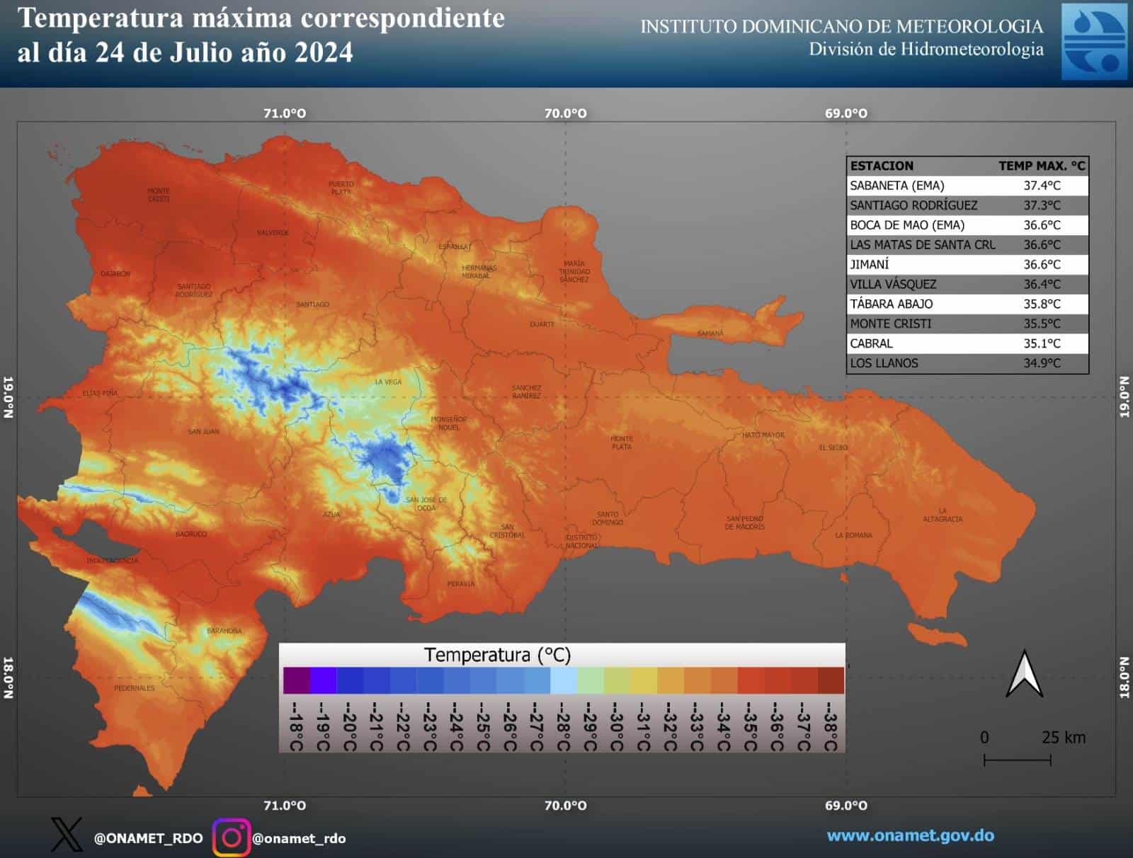
Last Wednesday, in municipalities of the Northwest Line, there were maxims up to 37 °C in Sabaneta (Santiago Rodríguez), 36.4 °C in Villa Vásquez (Montecristi) and Montecristi 35.5 °C.
recommendations
It is recalled that anticyclonic systems and the dust of the Sahara limit the occurrence of significant rainfall.
He Indomet maintains the recommendation to drink enough fluids, preferably water, wear light, light-colored clothing and avoid undue exposure to sunlight. protection at 11:00 in the morning and 4:00 in the afternoon.
Friday
This Friday, a mostly sunny atmosphere prevails over much of the country. sunnyvery warm and foggy.
“However, as a result of the indirect effects of a trough located over the eastern part of Cuba, as well as the local effects, typical of the national geography and the predominant east/southeast wind, we foresee occasional showers scattered in some provinces located in the regions: northeast, southwest, northwest, the border area and the Central Mountain Range mainly Montecristi, Dajabon, Santiago Rodriguez, Valverde, Santiago, Maria Trinidad Sanchez, Duarte, Monte Plata, Elias Pine, Pedernales, Barahona.
Saturday
On Saturday, the system anticyclonic and particles of dust Saharan will continue to inhibit the clouds that generate significant accumulated rainfall, causing a mostly clear sky to be observed sunnymisty and greyish in appearance.
Sunday
On Sunday the country will continue to be under the influence of the system anticyclonic and dust Saharan.

