Several tropical systems will maintain favorable atmospheric conditions for the continuation of the rains over the Dominican territory throughout the weekendwhile 75% of the provinces of the country are under alert.
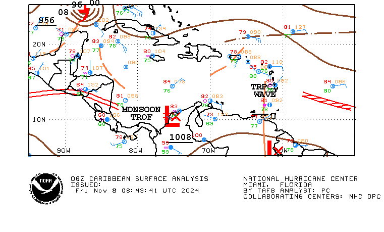
According to the report of the Dominican Institute of Meteorology (Indomet), this Friday a trough associated with a system of low pressure to the south/southwest of the country and on Saturday and Sunday a tropical wave which is currently southeast of Puerto Rico and a trough in height.
This Friday the trough It will keep the environment very conducive so that from the early hours of the day downpours moderate to strong at times, mainly in the provinces: Pedernales, Barahona, Independencia, Bahoruco, Elías Piña, San Juan, Santiago Rodríguez, Dajabón, Montecristi, Hermanas Mirabal, Espaillat, María Trinidad Sánchez, Puerto Plata, Santiago, La Vega, Valverde and Azua, among others nearby.
This Friday it is expected in the National District cloudy increases at times with downpours scattered thunderstorms and gusts of wind.
Saturday arrives tropical wave
The Indomet report indicates that this Saturday the incidence of trough in height and the arrival of the tropical wave They will keep the environment very conducive for them to show up downpours of varied intensity, especially in the afternoon, over Greater Santo Domingo Monte Plata, La Altagracia, El Seibo, Hato Mayor, Samaná, Sánchez Ramírez, Duarte, María Trinidad Sánchez, Monseñor Nouel, La Vega and Santiago, among others. provinces.

rainy sunday
On Sunday, the combination of humidity left by the tropical wave with the incidence of trough and the influence of wind moderate northeast will be generating cloudy increases with downpours moderate at times, on several provincesincluding Greater Santo Domingo and the National District.
The rains They will continue to spread even at the beginning of next week, according to Indomet.
Temperatures
The influence of that wind moderate northeast tends to improve temperatureswhile for Greater Santo Domingo a minimum temperature is expected between 20 °C and 22 °C and a maximum between 30 °C and 32 °C.
The alerts
The Emergency Operations Center maintains 24 provinces in alertof the total of 32 districts in the country, which is equivalent to 75%.
Of these 24 provincesnine are in yellow and 15 in green.
- The provinces in alert yellow are: Puerto Plata, María Trinidad Sánchez, Espaillat, El Seibo, Duarte, Samaná, Hermanas Mirabal, La Altagracia and Hato Mayor.
- The provinces in alert green are: Santo Domingo, National DistrictValverde, San Cristóbal, Peravia, Monseñor Nouel, Barahona, La Romana, Santiago, Monte Plata, La Vega, San Pedro de Macorís, Pedernales, San José de Ocoa and Sánchez Ramírez.
System northeast of the DR
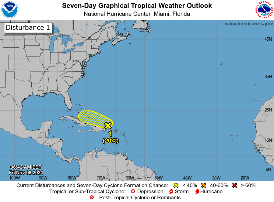
The authorities monitor a system located in the northeast of the country in the waters of the Atlanticwhich has a 20% chance of becoming a tropical cyclone in the next 48 hours.

According to the United States National Hurricane Center, regardless of the development of this system are possible rains locally strong through Dominican RepublicHaiti, Virgin Islands, Puerto Rico, and the southeastern Bahamas.
“Some gradual development of this is possible system over the next two days as it moves westward near the Greater Antilles,” he says.
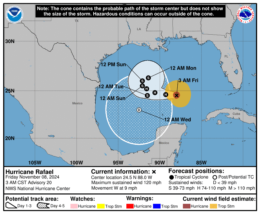
Raphael It is not a danger for the DR
He hurricane Raphael no longer represents a danger to the Dominican Republic and is located 395 kilometers north/northeast of Progreso, Mexico, with winds of 195 kilometers per hour.


