This Friday and during the weekend are expected rains in some provinces due to the effects of a troughwhile the temperatures hot, reaching 39 °C in certain places.
According to the report of the Dominican Institute of Meteorology (Indomet), this Friday will be dominated in the morning hours by mostly sunny conditions and few rainsbut that from noon onwards a trough will cause cloudy, followed by showers strong at times towards several provinces.
Are rains They would be concentrated mainly in: El Seibo, Hato Mayor, Monte Plata, Samana, La Vega, Santiago, Santiago Rodriguez, Dajabon, Montecristi, Valverde and Elias Pineda.
In it National District are expected clouds scattered to partly cloudy at times.
Saturday and Sunday
Tomorrow Saturday the occurrence of cloudy in the afternoon with showers strong in localities in the northwest, north, east, the Central mountain range and the border area, especially in: Hato Mayor, Monte Plata, Duarte, Maria Trinidad Sanchez, Monsignor Nouel, La Vega, Santiago, Valverde, Santiago Rodriguez, San Juan, Dajabon and Elias Piña, according to Indomet.
While on Sunday the humidity and local daytime warming effects will cause cloudy from morning hours, so there will be showers moderate to strong over several provincesespecially in: Hato Mayor, Monte Plata, Duarte, Maria Trinidad Sanchez, Monsignor Nouel, La Vega, Santiago, Valverde, Santiago Rodriguez, San Juan, Independence and Elias Pine.
Heat
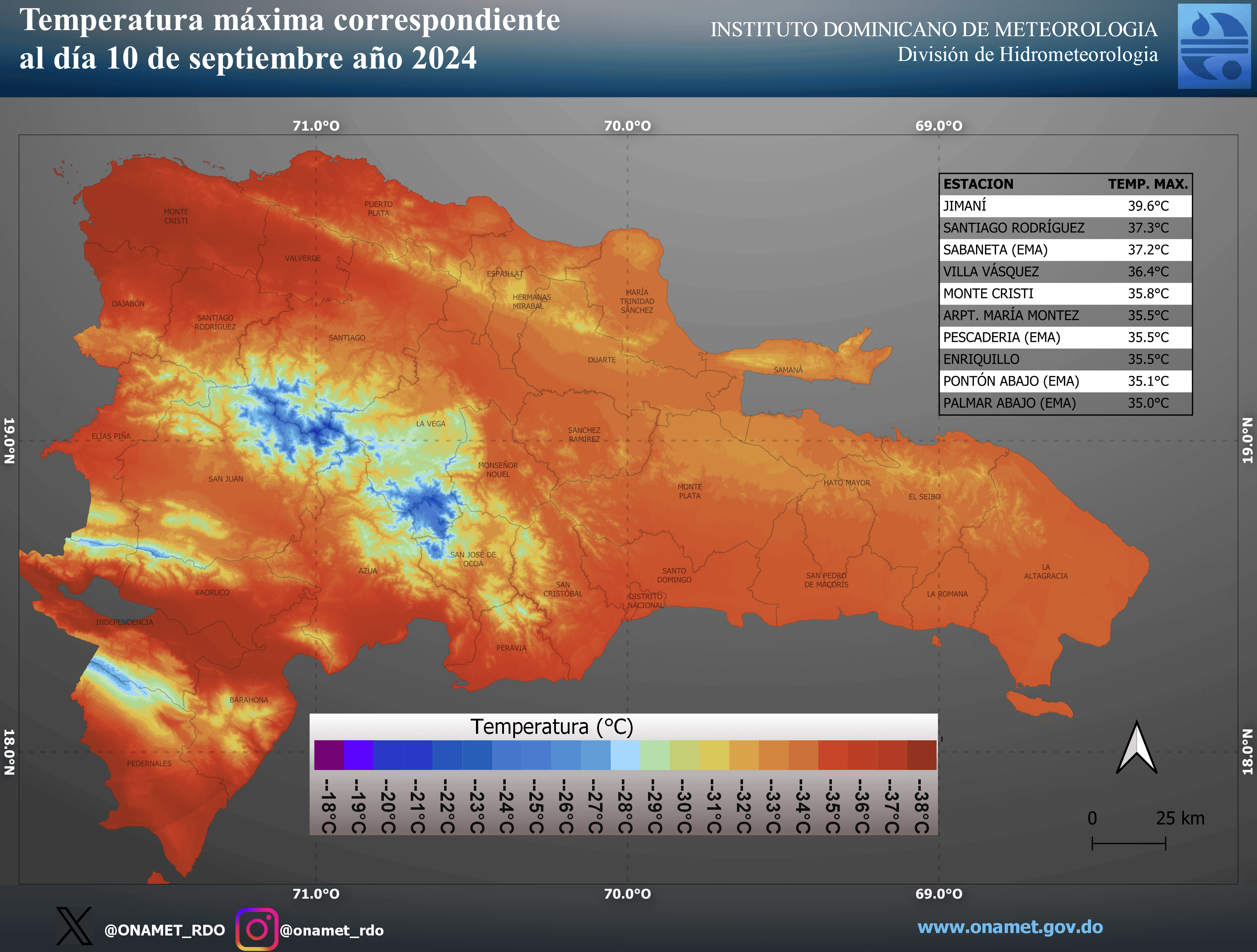
The temperatures They stay warm because of the summer And last Tuesday, for example, in Jimaní a temperature of 39.6 °C was recorded.

Yesterday, in the National District The maximum temperature was 33 °C at 2:37 p.m., according to the Indomet meteorological station.
RELATED
Monitors two systems
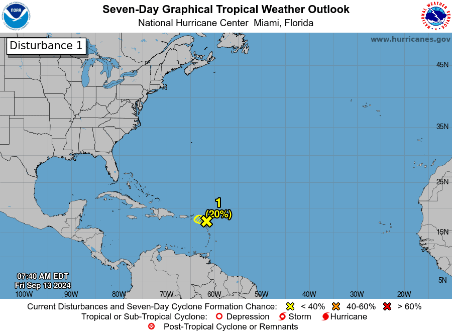
Authorities monitor an area showers and storms disorganized electrical activity, associated with a low pressure area over the northern portion of the Lesser Antilles Arc, with a 20% potential to develop into a tropical cyclone in the next 48 hours.

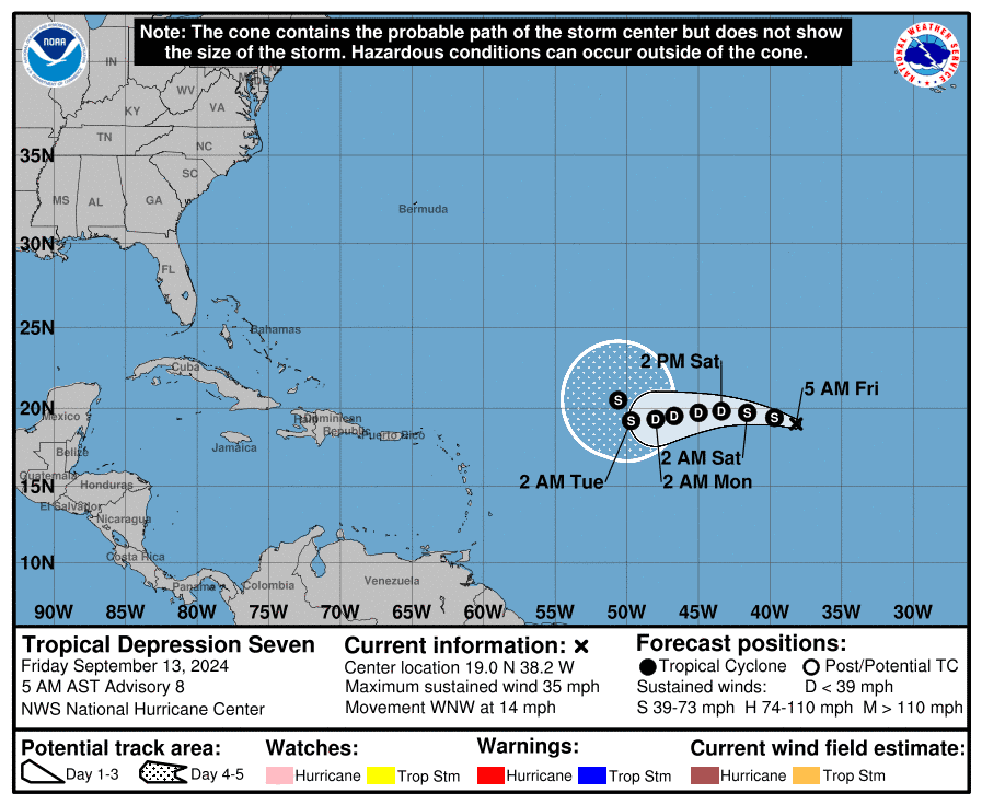
It is also followed by tropical depression seven is located on Friday morning 1,540 kilometers west-northwest of the Cape Verde Islands.

Maximum sustained winds are near 55 kilometers per hour and the tropical depression could become a tropical storm later today, according to the US National Hurricane Center (CNH).


