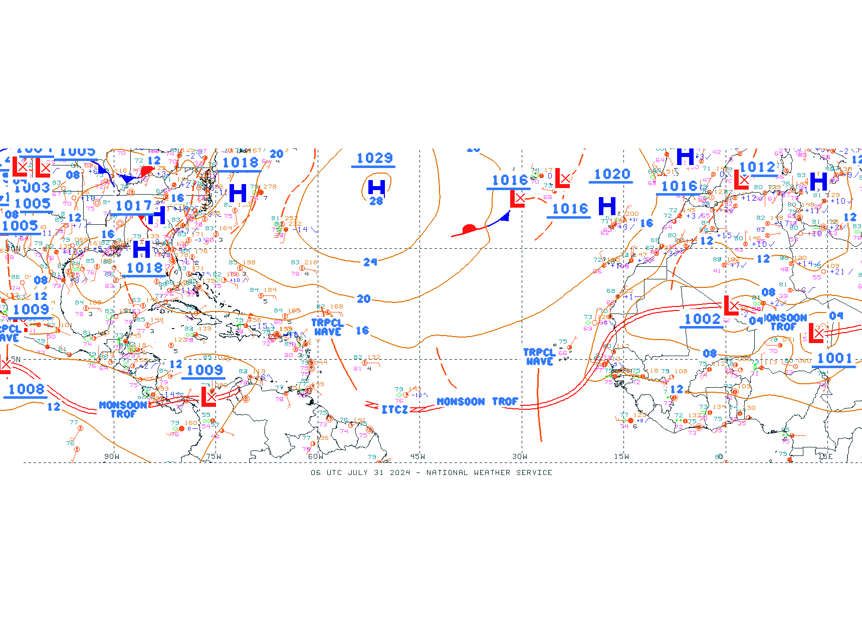
This Wednesday a mostly sunny atmosphere is expected sunny country with rains isolated in some areas, but from early Thursday morning an increase in the number of showers in much of the country by an active tropical wave and one trough.
According to the report of the Dominican Institute of Meteorology (Indomet), this Thursday will occur rains from the early hours of the morning and throughout the day, followed by showers strong at times over much of the country, especially concentrated over: Santo Domingo, the National District, Monte Plata, Sanchez Ramirez, La Altagracia, Samana, El Seibo, Maria Trinidad Sanchez, Elias Pine, San Juan, Barahona, Pedernales and San Pedro de Macoris.
Claudio Amparo, predictor of the Indometdetailed to Diario Libre that the rains Today, Wednesday, there will be isolated showers occurring from the end of the afternoon in some areas and they will not be very significant, but those expected this Thursday will be, with the possibility that they may be emitted. alerts meteorological.
“This Wednesday, in the morning hours, an atmosphere of clouds scattered and scarce rains over much of the territory. From midday until the evening hours, an increase in humidity is expected associated with a trough and the proximity of a tropical wave to the east of the island, which will induce showers scattered and occasional towards some provinces of the regions: northeast, the eastern plain, border area and the Central mountain range. Especially towards: La Altagracia, Hato Mayor, Monte Plata, Sanchez Ramirez, La Vega, Monsignor Nouel, San Pedro de Macoris, San Cristobal, Elias Piña, Dajabon, Greater Santo Domingo, La Romana and El Seibo,” said the Indomet.
The tropical wave which will affect Thursday
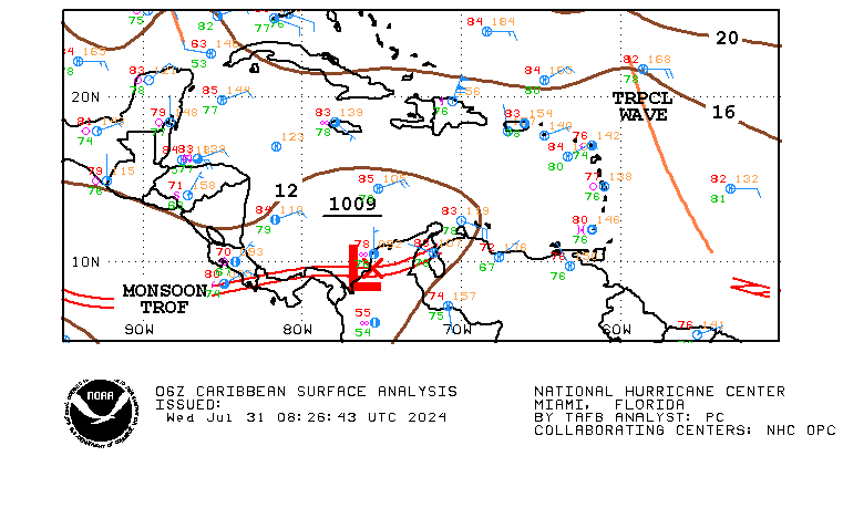
The active one tropical wave that will affect the country from this Thursday is currently located east of Puerto Rico.

Fridays continue showers
According to him Indometon Friday, the tropical wave It will be located on the central portion of the Caribbean and a low pressure zone to the northwest of the island will maintain a mostly cloudy environment accompanied by showers strong at times, mainly towards the regions: northwest, north, the Caribbean coastal line, as well as the Central Mountain Range and the border area.
Behind a system with probability of training
In addition to this tropical waveauthorities monitor an area of showers several hundred kilometers east of the Lesser Antilles.
This system presents a probability of 48 hours. training very low cyclonic pressure, 0%, and in the next 7 days, 60%, according to the United States National Hurricane Center (CNH).
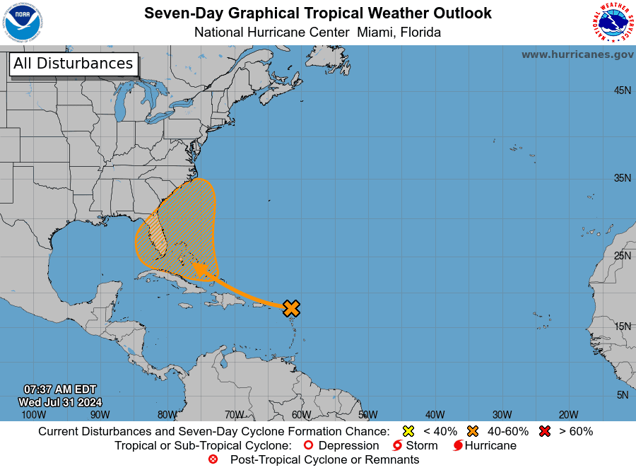
“Environmental conditions are forecast to gradually become more conducive for development as the system moves generally west-northwestward over the Greater Antilles and toward the Bahamas. A tropical depression could form by this weekend while the system is in the vicinity of the Greater Antilles, the Bahamas, or near Florida,” the NHC said.
Other tropical wave leaving from Africa
A tropical wave It is located southwest of the islands of Cape Verde near 28W from 16N to the south and moving west at 5 to 10 knots. Convection is evident near this tropical waveaccording to the CNH.
